Consulting Services for Bathymetric Survey of Karnali River for Betan Karnali PROR Hydroelectric Project
Project: Betan Karnali PROR Hydroelectric Project
Assignment: Consulting Services for Bathymetric Survey of Karnali River for Betan Karnali PROR Hydroelectric Project
Location: Surkhet and Achham District, Nepal
Client: NEA Engineering Company Limited
Duration: May 2019 to January 2020
Project Description: Betan Karnali Hydroelectric Project is a Peaking RoR project of installed capacity of 442 MW. The project is located in the border of Achham and Surkhet district. Its proposed headwork is located around 10 km from Lyati Bindraseni. The project has approximate catchment area of 22,555 km2 and uses design discharge of 536 m3/s in dry season and 580 m3/s in wet season. It generates total annual energy of 2319.42 GWh.
Scope of Services:
1. Identification of the nearest permanent BM and control points of BKHEP with reference with the D-card provided by the client;
2. Establishment of Permanent Ground control point in every 1 km stretch of the reservoir area and temporary BM at the proper site of the river for reference from DGPS;
3. Traverse survey from established Control Points/ BM along the 29 km stretch of river;
4. Bathymetric Survey over 29 km stretch at different section (Dam Site to end of reservoir (22 km) @ 250 m interval, around the Dam Location (100 m u/s to 400 m d/s) @ 50 m interval, around the tailrace outlet (300 m u/s to 500 m d/s) @ 100 m interval and at gauging station and automatic water level station;
5. Calculation of the closing error for traverse survey and check its error range;
6. Preparation of X-section, L-section profile GIS Mapping and Bathymetric Maps and report describing the activities undertaken including all necessary basic data, D-Card of Control Points/ Benchmarks and other records in two volumes (Vol I- Main report & Vol: II- Drawings)
7. Equipment Used:
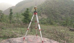
• Hiper HR DGPS (3 sets);
• Eco-sounder (measure depth up to 300m with accuracy of +/- 0.5% X depth)
• Total Station (2 sets);
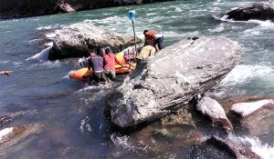
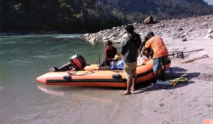
• Rafting Boat;
• Transducer and other related equipment.