Simbuwa Khola HPP Road alignment survey and Cadastral mapping work
Project: Simbuwa Khola Hydropower Project
Assignment: Simbuwa Khola HPP Road alignment survey and Cadastral mapping work
Location: Taplejung District, Nepal
Client: ITECO-SILT-UDAYA JV
Duration: September 2019 to September 2019

Project Description: The project is located in Tapethok VDC of Taplejung district of Nepal, utilizing the flow of Simbuwa Khola, a tributary of Arun River. The scheme is 70.34 MW Run-of-Rive type hydropower project with a gross head of 888.6 m and design discharge of 9.24 cumec at 40% flow exceedance level. The major structures of the project are the spillway weir, undersluice and appurtenant structures, approach canal, desanding basin, a headrace tunnel of 4.392 km length, which will lead to a 24.22m high surge shaft. The design flow will be directed towards the powerhouse through 2710.42 m pressure shaft. The annual energy generation from the project will be 378.96 GWh and the electricity generated will be evacuated through the Koshi Corridor.
Scope of Services:
1. Desk study of the route provided by the client;
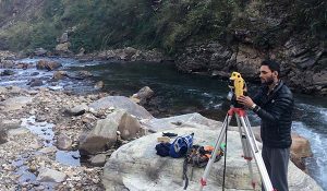
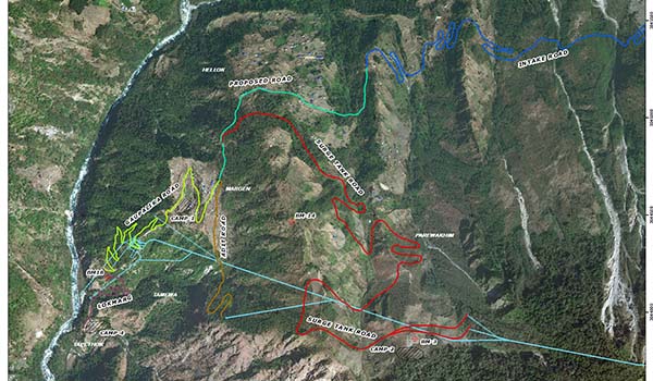
2. Road alignment walkover survey over project structure area part with guidance of client’s representative and recording of the center alignment by hand held GPS;
3. Recording reference point of identified plot at field and identification of different size and number of plots with the help of digital cadastral sheet provided by the client;
4. Different plot number production from digital cadastral at site in GIS and Excel;
5. Purchase of different document related to cadastral work, landowner information etc. from Napi office of Taplejung; and
6. Preparation and submission of softcopy draft and final report of the works performed.