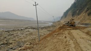
Detail Feasibility Study Navigation along Koshi River from Chatara to Tumlingtar
Project: Navigation along Koshi River
Assignment: Detail Feasibility Study Navigation along Koshi River from Chatara to Tumlingtar
Location: Sunsari, Udayapur, Dhankuta, Bhojpur and Sankhuwasabha Districts
Client: Nepal Shipping Office
Duration: January 2021 to September 2021
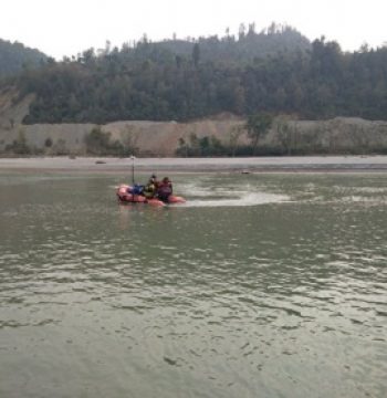


Project Description: The Koshi is a trans-boundary river which flows through Tibet, Nepal and India. It drains the northern slopes of the Himalayas in Tibet and the southern slopes in Nepal. Koshi River at Chatara is also called Saptakoshi. The tentative elevation of Koshi River around Chatara which is also the tentative terminal location at one end is around 120m. Chatara is located in the border of Sunsari and Udayapur district in Province 1. Similarly, tentative elevation of Koshi River around Tumlingtar is is around 305m. So, the water way goes from 305m at Tumlingtar to 120m elevation at Chatara with tentative water-way 75 km. ct.
Scope of Services:
1. Field Investigation and Data Collection
• Planning and Reconnaissance Survey
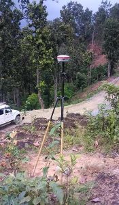
• Establishment of Bench Marks and Transfer of Control Points – – Data Collection, GNSS Planning, Spatial Planning, Monumentation of Benchmark, Control Survey, Computation of Co-ordinates,
• Bathymetric Survey – Underwater-Longitudinal and Cross-section Survey, Data Recording, Data Sampling and Correction, River edge to 5 m above HFL/ 100m from edge, Summary of Measurements,
• Obstacle Survey
• River Bends Detailing
• Mapping and Reporting
• Discharge Measurement-Measurement of Width, Spacing of the Measuring Verticals, Measurement of Depth, Measurement of Velocity, Computation of Discharge and Result Reporting
• Sediment Measurement – Sediment Sampling, Laboratory Analysis,
2. Hydrological Analysis
• Basin Characteristics
• Data Collection
• Mean monthly flow calculation
• Flood analysis
3. Hydraulic Modelling
• Input Parameters-Cross section data, Manning’s n value
• Flow data
• Boundary Condition
4. Navigability study – Recommended Navigation Plan, Impact of other projects on Navigability
5. Fairway Development – Fairway Design, Navigation Improvement Works
6. Planning of Terminals – Terminal Site Selection, Description of Proposed Terminals, Geotechnical Investigations and Soil Testing of proposed terminal sites.
7. Cost Estimates
8. Traffic Study
9. Environmental and Social Aspects
10. Economic Analysis
11. Reporting and Recommendations